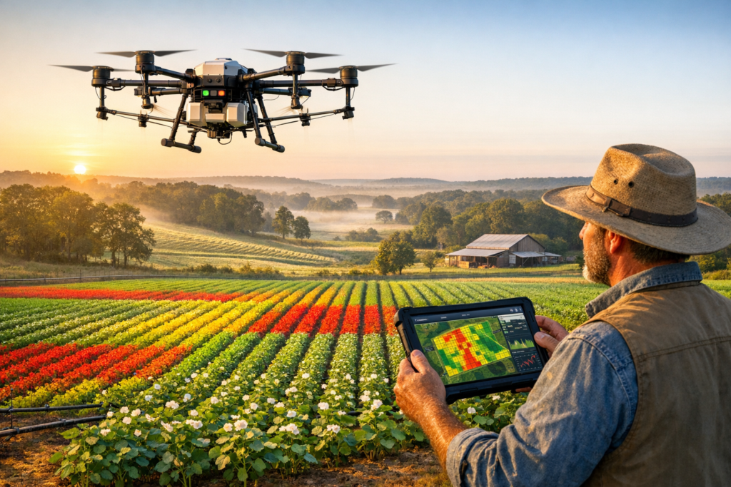
Drive past any field in East Texas on a spring morning and you might spot something new hovering above the rows—a drone, quietly collecting data that will shape every decision a grower makes for the rest of the season. That scene is becoming more common around Tyler TX, where precision agriculture aerial services are changing the way we think about food production, input costs, and land stewardship. At Doss Drone Services, we have spent years helping local producers turn raw aerial data into smarter, more profitable choices. What used to require a fleet of equipment, a crop consultant’s best guess, and a fair amount of luck can now be guided by hard numbers captured from just a few hundred feet in the air. In this article, we walk through the technology, the real-world benefits, and the reasons East Texas precision agriculture is gaining momentum faster than many people realize.
Why Precision Agriculture Aerial Services Are Reshaping the Field
Farming has always been a blend of science and intuition. Our grandparents read the sky, felt the soil, and hoped for the best. We still respect that wisdom, but we also know that adding a layer of reliable, real-time data makes every traditional skill more powerful. That is exactly what precision agriculture aerial services deliver—an overhead perspective that turns hunches into measurable action plans.
From Guesswork to GPS-Guided Decisions
When we launch a drone over a field near Tyler TX, we are not just taking pretty pictures. We are gathering georeferenced imagery through multispectral drone imaging that reveals details the human eye simply cannot detect from the ground. Each flight produces data tied to exact GPS coordinates, which feeds into GIS field mapping platforms and, ultimately, into farm management software that growers already use. The result is a seamless pipeline: fly, analyze, act.
Consider what this means in practical terms. A cotton producer in East Texas might suspect a nitrogen deficiency in the northeast corner of a 200-acre block. Without aerial data, the most common response is to blanket-apply fertilizer across the entire field. With precision agriculture, that same producer receives a georeferenced NDVI crop mapping layer showing exactly where the stress lives—down to a few square meters. Fertilizer application by drone then targets only the zones that need it, which can reduce input costs by 15 to 30 percent on a single pass.
Remote sensing for agriculture is not new in concept—satellites have offered coarse imagery for decades—but the resolution and turnaround time of drone-based remote sensing is what makes it transformative for everyday operations. We can fly in the morning and deliver actionable crop health index maps by afternoon. Satellite data, by contrast, often arrives days late and at resolutions too coarse for field-level decisions.
The Technology Behind the Insight
Our fleet carries multispectral sensors tuned to capture reflected light in bands that correspond to plant vigor, chlorophyll content, and moisture stress. From those bands we generate vegetation index layers—NDVI imaging being the most widely recognized—that grade every square meter of a field on a color-coded scale. Green means healthy canopy; yellow and red flag areas that need attention.
Those layers integrate with GIS mapping tools and variable rate technology (VRT) controllers already mounted on many modern tractors and sprayers. In other words, the data we collect does not sit in a PDF no one opens. It flows directly into the equipment that applies seed, fertilizer, or crop-protection products, enabling true variable rate application across the field. That closed loop—from aerial capture to machine execution—is the beating heart of precision agriculture.
Practical Applications That Deliver Measurable ROI in Tyler TX
Technology only matters if it pays for itself. We have seen it do exactly that across dozens of East Texas operations, from small family vegetable farms to large-scale row-crop enterprises. Below are the applications where agricultural drone services consistently move the needle.
Precision Agriculture Drone Spraying
Precision agriculture drone spraying is one of the fastest-growing segments of our work. Modern spray drones carry 10 to 40 liters of liquid product and apply it with centimeter-level accuracy using RTK GPS guidance. Compared with a traditional boom sprayer, a drone can treat irregularly shaped fields, waterway buffers, and terraced hillsides without leaving wheel tracks. That means we minimize soil compaction—a hidden yield thief that costs East Texas producers more than most realize.
Here is a snapshot of the advantages:
– Targeted herbicide application reaches only the zones where weeds are confirmed, cutting chemical use by up to 90 percent on spot-spray missions.
– Fertilizer application by drone handles liquid foliar feeds or granular micronutrients in fields too wet or too steep for ground rigs.
– Aerial crop spraying after a rain event can happen within hours, not days, because a 55-pound drone does not need the field to dry out the way a 15-ton sprayer does.
– Precision agriculture drone spraying supports sustainable farming practices by dramatically reducing drift, runoff, and off-target deposition.
We recently completed a precision agriculture drone spraying project on a hay operation south of Tyler TX where the landowner had been unable to spray fence lines and pond borders with conventional equipment. One flight covered the problem areas in under an hour, applying targeted herbicide application exactly where invasive brush was encroaching. The per-acre cost was competitive with a custom ground applicator, and the environmental footprint was a fraction of the alternative.
Crop Monitoring and Analysis
Crop monitoring and analysis is the other pillar of agricultural drone services. Regular flyovers—every two to three weeks during the growing season—build a time-series portrait of each field. We track changes in NDVI crop mapping layers from emergence through senescence, flagging anomalies the moment they appear.
This kind of crop scouting services workflow lets producers catch problems early:
– Pest and disease detection becomes proactive rather than reactive. A subtle drop in the vegetation index in one corner of a peanut field might indicate early leaf spot before any symptoms are visible at ground level.
– Irrigation inefficiencies show up as moisture-stress gradients that align with emitter failures or pressure drops.
– Yield mapping and yield analysis at season’s end correlate management zones with actual harvest data, closing the feedback loop for the following year.
Crop monitoring is where farm data integration really shines. We export our layers in formats compatible with popular farm management software platforms—Climate FieldView, John Deere Operations Center, AgLeader, and others—so the data lives where growers already make decisions.
How Doss Drone Services Supports East Texas Precision Agriculture
We are not a Silicon Valley startup parachuting into rural communities with flashy demos. Doss Drone Services is rooted right here in Tyler TX, and our passion is helping our neighbors farm smarter without adding complexity to their days.
Our Service Workflow
Every engagement follows a simple, repeatable process:
1. Consultation – We walk the field with the producer, understand the crop plan, and identify the highest-value questions aerial data can answer.
2. Flight Planning – Using GIS field mapping software, we design flight paths that cover every acre at the optimal altitude and overlap for the sensor package in use.
3. Data Capture – Our pilots—all FAA Part 107 certified—fly the mission, collecting multispectral drone imaging and high-resolution RGB photography.
4. Processing and Analysis – Back in the office, we stitch imagery, generate NDVI imaging layers, crop health index maps, and any custom analytics the producer requested.
5. Delivery and Action – Reports arrive in the producer’s inbox—or directly in their farm management software—with plain-language recommendations. If precision agriculture drone spraying is the next step, we can handle that too.
This end-to-end approach is what sets Doss Drone Services precision agriculture apart. We own the entire chain from sensor to spray nozzle, which means fewer vendors, fewer handoffs, and faster time to action.
Why Local Expertise Matters
East Texas precision agriculture demands local knowledge. Our soils range from deep Nacogdoches sandy loams to tight Crockett clays, and what works on one side of a county road may fail on the other. We understand those nuances because we live here. When we interpret a remote sensing layer, we are not just reading pixels—we are reading the landscape through years of ground-truth experience.
That local lens also means we understand the crops that matter most to our region: hay and forage grasses, improved pasture, timber, row crops like corn and soybeans, and specialty plantings including blueberries and peaches. Each crop has its own spectral signature, its own stress indicators, and its own economic thresholds. Doss Drone Services precision agriculture protocols are tuned to those local realities.
The Bottom-Line Benefits—and What Comes Next
Every technology adoption boils down to one question: does it pay? The evidence around precision agriculture aerial services is increasingly clear—and the returns go beyond the balance sheet.
Financial Gains
– Reduce input costs: Variable rate application of fertilizer and crop-protection products consistently saves 10 to 30 percent compared with uniform-rate programs.
– Increase crop yield: Early pest and disease detection and site-specific nutrient management routinely lift yields by 5 to 15 percent, depending on the crop and baseline management level.
– Lower equipment costs: A drone pass that replaces a tractor pass means less fuel, less wear, and less labor. It also helps minimize soil compaction, protecting the soil structure that underpins long-term yield optimization.
Environmental and Community Value
Sustainable farming practices are not a buzzword for us—they are a business imperative in a region where agriculture sits alongside residential neighborhoods, recreational lakes, and sensitive ecosystems. Aerial crop spraying with drones uses dramatically less water carrier than ground rigs, reduces chemical drift, and keeps heavy machinery off fragile soils. When we help a producer reduce input costs while also cutting runoff into a creek, everyone wins.
Looking ahead, the integration of artificial intelligence with crop scouting services and yield analysis promises even greater precision. Machine-learning models trained on years of multispectral data will soon predict stress events before they happen, giving producers a true early-warning system. We are already piloting some of these tools in our Doss Drone Services precision agriculture program, and the early results are encouraging.
Yield optimization is ultimately about making better decisions faster. Whether you run 50 acres of hay or 5,000 acres of row crops around Tyler TX, precision agriculture aerial services give you the information advantage that separates a good year from a great one. We have watched producers in our community increase crop yield, reduce input costs, and sleep a little easier knowing their fields are being watched by more than just the weather.
Ready to See Your Farm from a New Perspective?
If you have been curious about how agricultural drone services could fit into your operation, we would love to start the conversation. Our team at Doss Drone Services is here to answer questions, schedule a demo flight, or simply walk your field and talk through the possibilities. East Texas precision agriculture is not a future trend—it is happening right now, and the producers who embrace it first are the ones building the most resilient operations.
Reach out to us today at dossdronetx.com to learn how precision agriculture aerial services can work for your farm. Whether you need crop monitoring and analysis, precision agriculture drone spraying, or a full-season aerial crop spraying program, we are ready to help you farm smarter, save money, and protect the land you love.