
Why Construction Teams Are Rethinking How They See the Job Site
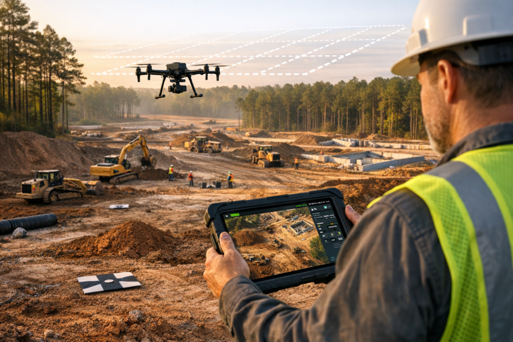
There is a quiet revolution happening on construction sites across East Texas, and most people never even look up to notice it. While heavy equipment rumbles and crews lay foundations, a small drone lifts off from a nearby clearing and begins capturing data that will shape every decision made on that project for months to come. We have watched this transformation unfold firsthand from our home base in Palestine TX, and we can tell you that aerial mapping services have fundamentally changed the way builders, developers, and landowners approach every phase of a project. What once required weeks of ground-based survey work, significant labor costs, and a fair amount of guesswork now happens in a fraction of the time with dramatically higher accuracy. In this article, we walk you through exactly how these services work, why they matter, and what makes them such a powerful but often overlooked advantage for construction projects and land development throughout the region.
The Technology Behind Modern Aerial Mapping Services
When we talk about aerial mapping services, we are really talking about a sophisticated ecosystem of hardware, software, and expertise working together to produce deliverables that were nearly impossible to obtain affordably just a decade ago. Understanding the technology helps explain why the results are so transformative.
How Photogrammetry and Drone Mapping Services Create Accurate Models
At the core of our process is photogrammetry, the science of extracting measurements and spatial data from overlapping photographs. When we deploy drone mapping services on a construction site or undeveloped parcel, our aircraft follows a precisely programmed flight path, capturing hundreds or even thousands of high-resolution aerial imagery frames with significant overlap. Each image is geotagged with exact positional coordinates.
Once the flight is complete, specialized software stitches these images together to produce an orthomosaic map, which is essentially a geometrically corrected aerial photograph that can be measured and analyzed just like a traditional survey drawing. From that same dataset, we generate additional deliverables including a digital elevation model (DEM), a point cloud consisting of millions of individual spatial data points, and fully textured 3D mapping reconstructions of the terrain and any existing structures.
To ensure the highest possible positional accuracy, we establish ground control points (GCPs) across the project area before flight. These are physical markers whose exact coordinates we measure using survey-grade equipment. Our UAV mapping platforms also utilize RTK/PPK drone positioning technology, which corrects satellite navigation errors in real time or during post-processing. The combination of GCPs and RTK/PPK correction allows us to achieve centimeter-level accuracy, which is exactly what construction and land surveying support applications demand.
What Sets Professional UAV Mapping Apart from Consumer Drones
Anyone can buy a drone at a retail store and snap aerial photos. What separates professional aerial survey work from hobbyist photography is the entire chain of calibration, flight planning, processing, and quality assurance that goes into every dataset we deliver. Our pilots are FAA Part 107 certified, which means we meet the federal requirements for commercial drone operations, including airspace authorization, safety protocols, and operational knowledge.
We also fly purpose-built UAV mapping platforms equipped with calibrated cameras designed for photogrammetric accuracy. The sensors capture consistent exposure and overlap patterns that consumer drones simply cannot replicate reliably. The result is accurate geospatial data you can stake your project timeline and budget on, not just a pretty picture from above.
Beyond the hardware, we invest heavily in processing infrastructure and software. Generating an orthomosaic mapping product, a dense point cloud, or a detailed digital elevation model requires significant computational power and expertise in geospatial analysis. We deliver these products in formats compatible with the GIS mapping platforms and CAD software that engineers, surveyors, and project managers already use, making integration seamless.
How Aerial Mapping Services Quietly Transform Construction Projects in Palestine TX
Construction is inherently complex. Timelines slip, budgets balloon, and miscommunication between teams costs money every single day. We have seen aerial mapping services address many of these pain points in ways that are not always obvious until you experience the difference yourself.
Pre-Construction Planning and Site Assessment
Before a single shovel breaks ground, our clients in Palestine TX and throughout East Texas use topographic mapping data to understand exactly what they are working with. A detailed topographic map derived from drone mapping services reveals elevation changes, drainage patterns, vegetation density, and existing infrastructure that might not be apparent from a windshield survey or even from walking the property.
This matters enormously for construction site mapping because grading plans, stormwater management designs, and foundation engineering all depend on accurate terrain data. When a civil engineer can open a GIS mapping file containing a centimeter-accurate digital elevation model of the entire site, they can make better design decisions faster. We have seen projects in East Texas where early topographic mapping caught drainage issues that would have caused costly redesigns if discovered during construction.
For property mapping purposes, our pre-construction surveys also help clarify boundary conditions, easement locations, and access constraints. While we are not licensed land surveyors, our data provides exceptional land surveying support by giving surveyors a rich spatial dataset to work from, reducing their field time and increasing their efficiency.
Construction Progress Monitoring and Volumetric Analysis
Once construction begins, the real magic of drone mapping services reveals itself in ongoing construction progress monitoring. We fly sites at regular intervals, whether weekly, biweekly, or monthly, to capture the evolving state of the project. Each flight produces a fresh orthomosaic map and 3D mapping model that project managers can compare against previous datasets and the original design plans.
This comparison capability is incredibly powerful. Superintendents can visually verify that work is proceeding according to plan without spending hours walking every corner of a large site. They can share high-resolution aerial imagery with owners, architects, and remote stakeholders who cannot visit in person. We have had clients tell us that a single set of construction progress monitoring images prevented a dispute that would have cost tens of thousands of dollars.
Volumetric measurements represent another area where our aerial survey data delivers direct financial value. When earth is being moved, whether for excavation, fill placement, or stockpile management, knowing the exact volume of material is critical for payment verification and logistics planning. Our 3D mapping models allow us to calculate volumetric measurements with high precision, comparing cut and fill quantities against design specifications. This eliminates the guesswork and the disagreements that often arise between contractors and owners over how much material has actually been moved.
Here is a quick summary of what construction teams typically gain from recurring aerial mapping services:
– Accurate as-built documentation at every project milestone
– Early detection of deviations from grading plans or structural layouts
– Visual communication tools for stakeholder meetings and progress reports
– Verified volumetric measurements for earthwork pay applications
– Historical records that protect against claims and disputes
– Reduced need for repetitive ground-based surveys
Beyond the Job Site: Applications Across East Texas Industries
While construction site mapping is one of our most active service areas, the same technology and expertise apply across a surprisingly wide range of industries throughout the region. East Texas aerial mapping serves landowners, ranchers, farmers, municipalities, and utility operators in ways that are equally transformative.
Agricultural Mapping and Drone Mapping for Ranches
Agriculture remains a cornerstone of the East Texas economy, and agricultural mapping has become one of our fastest-growing service categories. Farmers and ranchers use high-resolution aerial imagery to monitor crop health, identify irrigation problems, assess pasture conditions, and plan land improvements with a level of detail that ground-level observation simply cannot match.
Drone mapping for ranches is particularly valuable in our area because of the sheer size of many properties. Walking or driving a thousand-acre ranch to assess fence lines, water features, and grazing conditions takes days. A single UAV mapping flight can cover that same area in hours and produce an orthomosaic map that the landowner can study from the comfort of their office.
We have worked with drone mapping for landowners who needed accurate property mapping for estate planning, conservation easement documentation, or real estate transactions. In these cases, having precise acreage calculations, boundary references, and visual documentation adds significant value and credibility to the process. Agricultural mapping data also integrates with GIS platforms that agronomists and land managers use for precision agriculture, making our deliverables a natural fit for modern farm operations.
Drone mapping for ranches also supports wildlife management and habitat assessment. Landowners enrolled in wildlife management programs can use our aerial survey data to document habitat features, water sources, and vegetation types required by their management plans.
Infrastructure Inspection and Municipal Planning
Infrastructure inspection is another area where East Texas aerial mapping delivers exceptional return on investment. Bridges, communication towers, rooftops, pipelines, and solar installations all require periodic inspection, and many of these structures present significant safety challenges for human inspectors. Our drone mapping services allow us to capture detailed imagery and 3D mapping models of infrastructure assets without putting anyone in a dangerous position.
Municipalities and utility providers in the region, including areas around Longview TX drone services coverage, have begun incorporating aerial survey data into their asset management and planning workflows. A GIS mapping database enriched with current orthomosaic mapping imagery and accurate geospatial data becomes a powerful tool for capital improvement planning, zoning analysis, and emergency response preparation.
We have also supported infrastructure inspection projects where LiDAR-equipped platforms were appropriate. LiDAR uses laser pulses to penetrate vegetation canopy and map the ground surface beneath, which is particularly useful in the heavily wooded areas common throughout East Texas. When combined with photogrammetry data, LiDAR provides an even more complete picture of terrain and infrastructure conditions.
For Longview TX drone services and surrounding communities, the ability to quickly and safely inspect aging infrastructure represents a meaningful improvement in public safety and fiscal responsibility. Construction progress monitoring for public works projects also gives taxpayers and elected officials confidence that their investments are being managed effectively.
Choosing the Right Partner for East Texas Aerial Mapping
Not all providers are created equal, and the quality of your aerial mapping services directly affects the quality of every decision made from that data. We believe a few factors should guide your selection.
Credentials, Equipment, and Local Expertise
First, confirm that your provider is FAA Part 107 certified. This is non-negotiable for any commercial drone operation, and it signals that the pilot understands airspace regulations, safety procedures, and operational best practices.
Second, ask about equipment. Professional-grade UAV mapping platforms with calibrated sensors produce fundamentally different results than consumer drones. Ask whether the provider uses ground control points, whether they employ RTK/PPK drone positioning, and what accuracy specifications they guarantee. These details determine whether the accurate geospatial data you receive will actually hold up under engineering scrutiny.
Third, consider local knowledge. We operate from Palestine TX, and we know this landscape intimately. The rolling terrain, dense timber, creek bottoms, and clay soils of East Texas present unique challenges for both flight planning and data interpretation. East Texas aerial mapping requires an understanding of local conditions that a provider flying in from hundreds of miles away may not possess.
Here are the questions we recommend asking any aerial mapping services provider:
– Are you FAA Part 107 certified for commercial operations?
– What UAV mapping platforms and sensor types do you use?
– Do you establish ground control points for positional accuracy?
– What deliverables do you provide, such as orthomosaic maps, DEMs, point clouds, or 3D models?
– Can you deliver data in formats compatible with our GIS or CAD software?
– Do you have experience with construction site mapping, property mapping, or agricultural mapping in this region?
– What is your turnaround time from flight to final deliverable?
Deliverables That Drive Decisions
Ultimately, the value of drone mapping services lives in the deliverables. A beautiful aerial photo is nice, but what moves projects forward is a georeferenced orthomosaic map that an engineer can measure from, a digital elevation model that a grading contractor can build against, or a volumetric measurements report that settles a payment dispute before it escalates.
Our commitment at Doss Drone Services is to provide deliverables that serve as genuine decision-making tools. Whether you need topographic mapping for a new commercial development, construction progress monitoring for an ongoing build, property mapping for a land transaction, or agricultural mapping for a ranch management plan, we process and deliver data that integrates into your existing workflow and earns its place in your project budget.
We also believe in education. We want our clients to understand what they are looking at when they open a 3D mapping model or query a GIS layer. The more you understand the data, the more value you extract from every flight.
Your Project Deserves Better Data
Every construction project, land development effort, and property management decision in East Texas benefits from seeing the full picture. Aerial mapping services have moved from luxury to necessity for professionals who want to stay competitive, reduce risk, and make confident decisions backed by accurate geospatial data. From the first pre-construction aerial survey to the final as-built documentation, the insights captured by professional drone mapping services compound in value at every stage.
We are Doss Drone Services, proudly based in Palestine TX and serving landowners, builders, farmers, and municipalities across the region. Our passion is turning airspace into insight, and we would love the opportunity to show you what your next project looks like from above.
Ready to see the difference? Visit us at dossdronetx.com to learn more about our capabilities, request a quote, or schedule a consultation. Let us put accurate, actionable aerial data to work for your project.